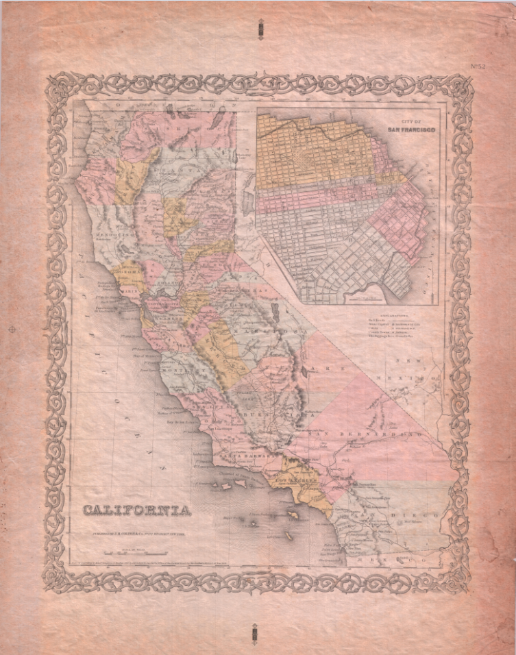
Described in Carl I. Wheat’s
The Maps of the California Gold Region 1848-1857, this 1855 map of California published by J. H. Colton & Co. New York, is hand colored by county and shows an inset of San Francisco.
This map shows only six counties of southern California including Buena Vista County, predecessor of Kern County, some northern California counties yet to be created, and Klamath County, later disestablished and divided between Siskiyou, Humboldt, and Del Norte Counties.
Original is a lithograph 12 ½ x 15 ¾ inches not including the decorative frame.
This selection is one of many historical maps included in California State University, Chico Meriam Library’s digital map collection which is a part of the
CSU Chico Digital Collections.
The Meriam Library’s Special Collections Department contains maps and photographs, manuscripts and local history, encompassing the 12-county region of Northeastern California. Collections are open to the public and more information and links to collections can be found on our website:
https://library.csuchico.edu/special-collections